Chapter 09 of 092026
You are here
The newest owners take the keys to a 1965 brick ranch and a long hay strip up the hollow, and start the next chapter by fixing up what the Hendleys left.
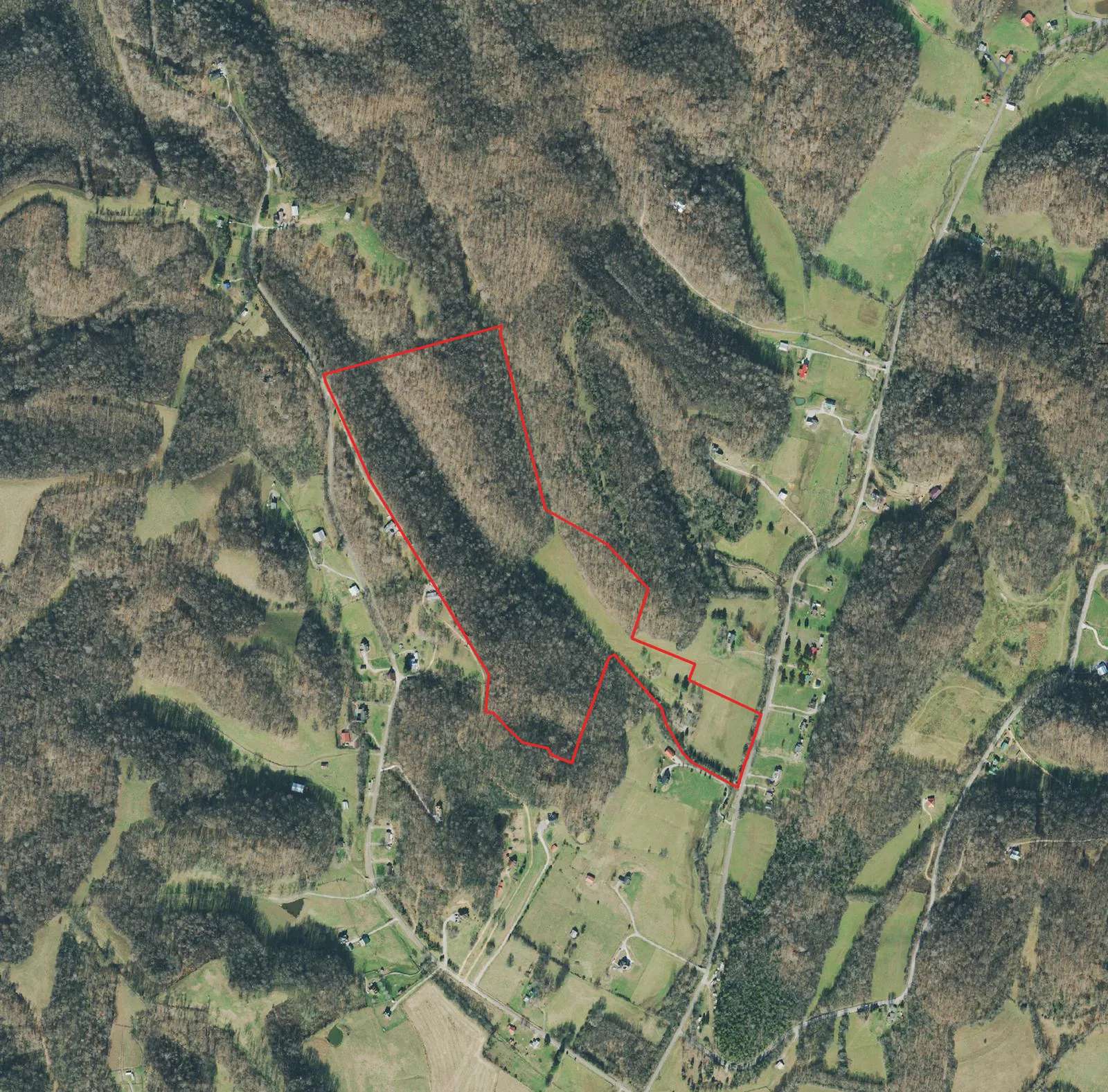
Aerial photo of the Knob Creek Road tract (parcel outline added). USDA Farm Service Agency, National Agriculture Imagery Program (NAIP); served by U.S. Geological Survey · USGS NAIP Imagery service (The National Map) · 2021-12-12 · Public domain (U.S. federal government work)
On August 14, 2026, the farm at the end of this story changed hands. For more than fifty years it had belonged to one family, Joe and Joan Hendley and then their daughters. Now it belongs to the Schultzes, who came looking for room to grow and found seventy-five acres of ridge, hollow and creek.
today
2021 aerial
Pinch or ctrl + scroll to zoom. The red outline marks the 75 acres.
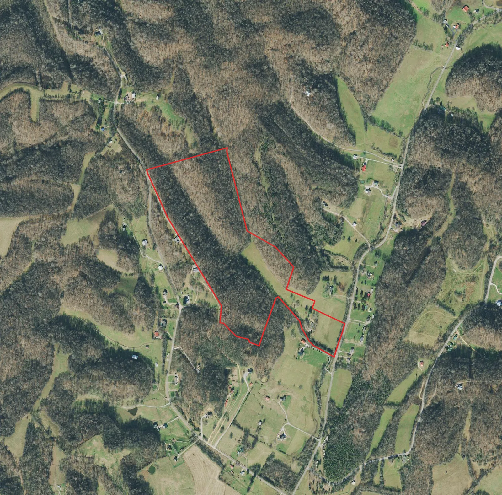
2021 aerial: USGS NAIP Imagery service (The National Map) · 2021-12-12 · Public domain (U.S. federal government work). Parcel outline: TN Comptroller parcel layer.
Swipe back through the maps and the shape of the place barely changes. The creek still runs along the road. The two wooded ridges still pinch together at the head of the hollow. The open strip between them, cream on the 1936 map and green in the photos, is still open. Somebody has kept it that way for at least ninety years, first with mules and plows, later with tractors and hay rakes.
The house
The house is a single-story brick ranch, built in 1965 according to the county record. It does not appear on the 1964 aerial photos that USGS used for its 1965 map. It does appear, as a small purple square, on the 1988 revision, which was drawn from photos taken in 1981. That fits the record: the Hendleys built near the mouth of the hollow while their daughters were young, and stayed.
The new owners plan to keep it. A 1965 brick ranch is a sturdy thing, and the work ahead is mostly about light and flow: opening up the middle of the house so the kitchen and the fireplace share a room, new windows, and in time finishing the basement underneath. The red metal building out back will become a workshop. None of it changes the outline you see from the air.
The strip
The hay field is the farm's defining feature. On the 2021 aerial photo it runs straight up the hollow for roughly 1,100 feet, about 180 feet wide, and opens into the lower field near the house. Counting that lower field, there is roughly 1,500 feet of open ground in a nearly straight line.
That straightness has given the family an idea: a private grass airstrip. It is only an idea for now. A strip like this has to be measured on the ground, checked for slope and drainage, and judged for how safely a small plane can climb out between two wooded ridges on a hot Tennessee afternoon. Federal rules require notice to the FAA before a private landing area is opened. If the numbers do not work, the strip stays what it has always been, a hay field.
Keeping the land working
Part of the plan is simply to keep doing what the land already does. The hay is still cut. The ridges stay wooded. The creek frontage stays wild, a green buffer between the road and the house. A pond, a garden, a trail loop up the ridge and back: those are ideas for later, after a full year of watching how water moves across the place and where the sun lands in winter.
- 1936TVA surveyors map the hollow as open ground with a stream down the middle.
- 1964Aerial photos for the next survey show no buildings inside today's property line.
- 1965The brick ranch goes up near the mouth of the hollow (county record).
- 1981New aerial photos show buildings in the east end of the farm; USGS adds them in purple on its 1988 map.
- 2021A December aerial photo shows the hay strip mowed and the ridges bare for winter.
- 2026August 14: the farm changes hands for the first time in more than half a century.
You are here
Two hundred years ago this hollow was the far edge of the Duck River country, newly opened by treaty and claimed by families from Virginia and the Carolinas. A Baptist congregation gathered a couple of miles down the creek. Surveyors came and went. The Hendleys arrived, farmed, built, and stayed for half a century.
Now a new family stands at the mouth of the same hollow, looking up the same strip of grass. Every layer of the map is still there to toggle: 1901, 1936, the 1940s, 1965, 1988, and today. The land kept its shape through all of them. The stories are what changed.