Chapter 05 of 091901 to 1945
The hollow on paper
Federal mapmakers draw the hollow again and again, from a rough 1901 sketch to the detailed TVA survey of 1936, and the open strip up the middle is already there.
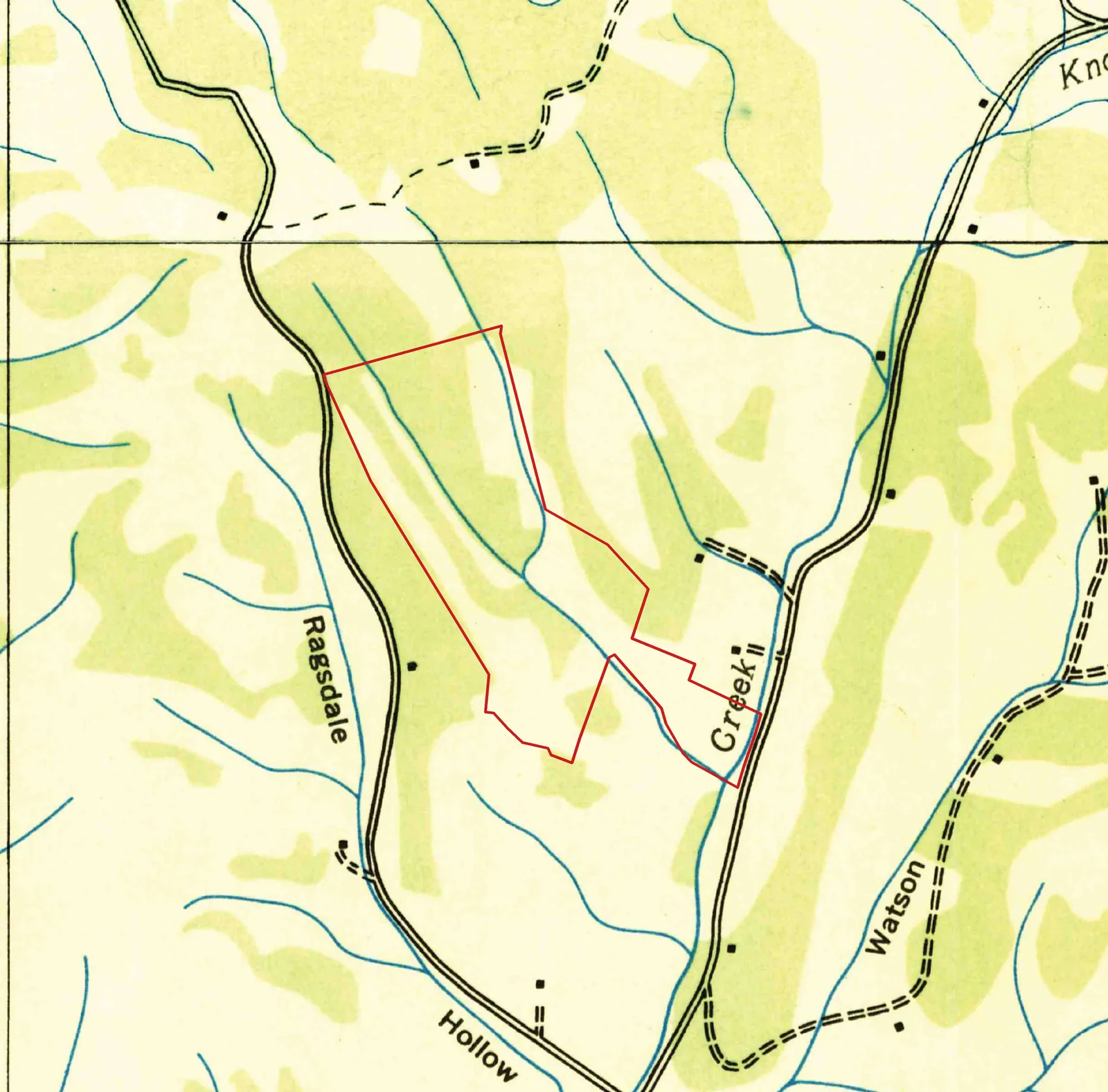
Godwin and Theta, Tenn. 7.5-minute quadrangles (detail, parcel outline added). Tennessee Valley Authority, Maps and Surveys Division; scans by U.S. Geological Survey · USGS Historical Topographic Map Collection (topoView) · 1936 · Public domain (U.S. federal government work)
Long before anyone in the family thought of this hollow as home, federal mapmakers had already drawn it. Five times between 1901 and 1941 they came through this corner of Maury County, and each time they left a slightly sharper picture of the same piece of ground.
1936
1936 TVA survey
Pinch or ctrl + scroll to zoom. The red outline marks the 75 acres.
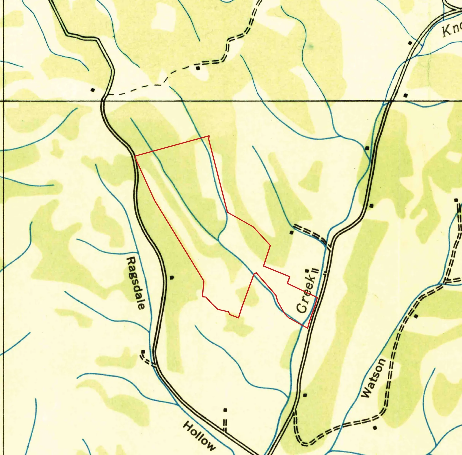
1936 TVA survey: USGS Historical Topographic Map Collection (topoView) · 1936 · Public domain (U.S. federal government work). Parcel outline: TN Comptroller parcel layer.
A rough first sketch
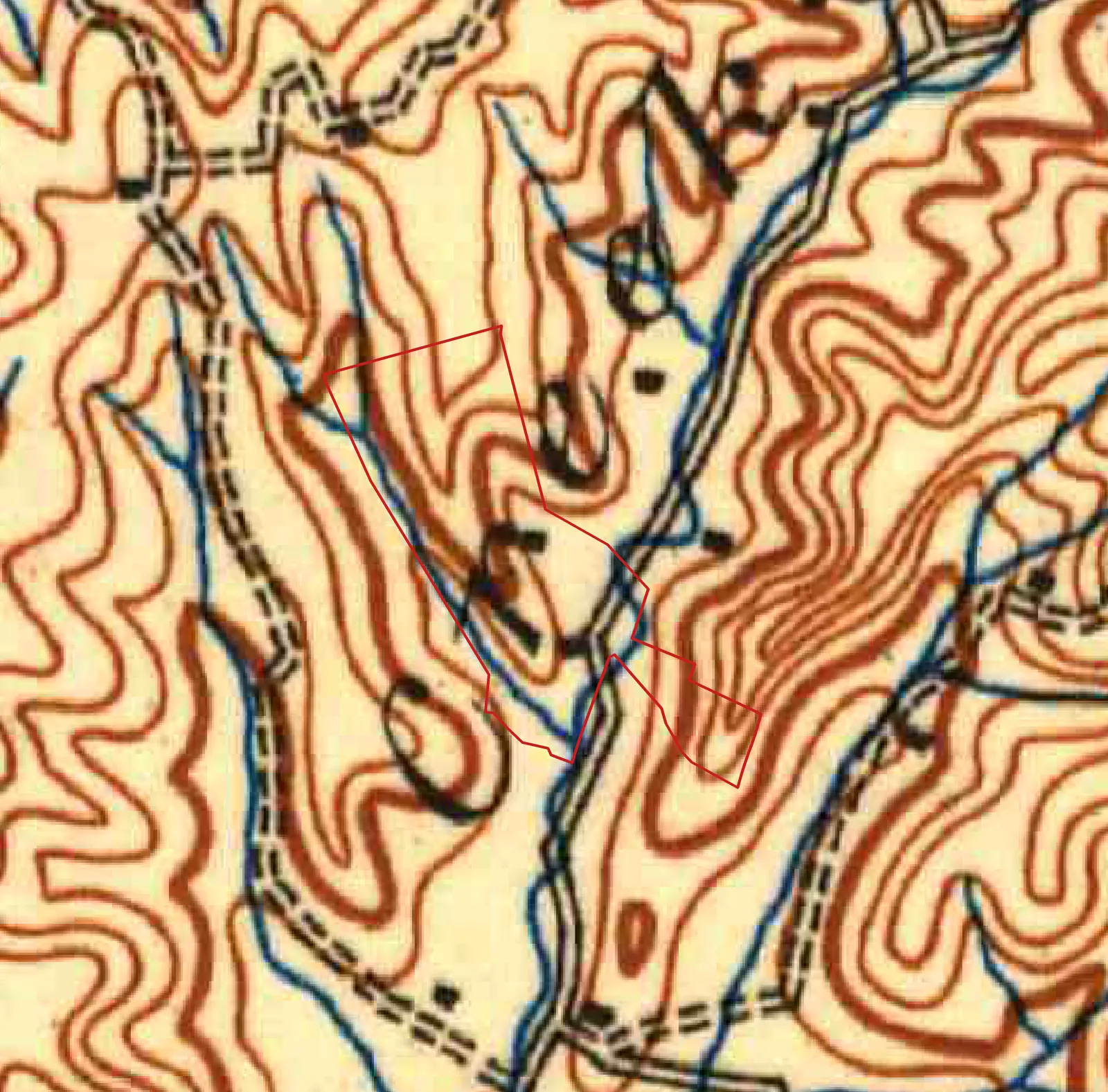
The oldest map that shows the farm is the 1901 Columbia sheet from the U.S. Geological Survey. It covers a huge area at a small scale, so the hollow is only a crease between brown contour lines. Still, it gets the big things right. Knob Creek is named in tall italic letters. A road follows the creek up the valley, more or less where Knob Creek Road runs today. The ridges on either side are steep and many.
The TVA comes to map
In 1933 Congress created the Tennessee Valley Authority to tame the Tennessee River and its tributaries, the Duck River among them. To plan dams, power lines and farm programs, TVA needed accurate maps, and it set out to survey the valley at a scale of one inch to 2,000 feet.
The Godwin sheet, which covers the farm, carries TVA's name across the top and the name of its chairman, Arthur E. Morgan. A note in the corner explains how it was made: compiled from aerial photographs, checked against survey control, with field examination in 1936. Someone flew over this hollow in the mid-1930s with a camera pointed straight down, and someone else walked or drove the roads to check what the photos showed.
That 1936 map is the clearest early portrait of the land. Woods are printed in green, open ground in pale cream, streams in blue, houses as small black squares. The long hollow at the center of today's farm is cream: cleared, unwooded ground with a stream running down its middle. The ridges on both sides are mostly green. The pattern is almost exactly what you see in an aerial photo today. The hay strip is ninety years old at least.
A farmstead at the mouth of the hollow
No buildings sit inside today's property line on the 1936 map. But right at the mouth of the hollow, beside Knob Creek and just across the north line, there is a small black square: the mapmakers' symbol for a dwelling. A second house sits a little farther north, up a side hollow at the end of a lane.
The house by the creek does not last. It is gone from the 1940 and 1941 editions. By 1965 an open square, the symbol for a barn or other outbuilding, marks about the same spot, and a house stands there again on the 1988 map and in today's aerial photos, on the neighboring lot. The house up the side hollow, by contrast, shows on every map from 1936 to 1988.
Who lived by the creek in 1936 is not recorded on the map. It was probably a farmhouse tied to the fields around it, maybe the hollow itself, sited where farmhouses usually were in this country: by the road, by water, at the foot of the field. It could have been an owner's house or a tenant's. A mapping change between editions can also make a building seem to vanish, so its disappearance is a clue, not proof. The deed that would name the owner of that time sits in Deed Book 437 at the Maury County courthouse, and it has not yet been read for this project.
Contours arrive
The 1936 sheet shows woods and fields but no elevations. The 1940 and 1941 editions add brown contour lines every 20 feet, and the shape of the land jumps off the page. The hollow floor climbs gently from about 700 feet near Knob Creek to about 800 feet at its head. The ridges on either side rise to roughly 880 to 900 feet, with Ragsdale Road running along the high ground to the west. The hollow is a narrow trough between them, draining southeast to the creek.
To the north of the farm, the maps in this layer come from the 1936 Theta sheet, because the Godwin sheet stops at a latitude line that crosses just above the property. You can see the seam where the contour lines end.
- 1901USGS publishes the Columbia 1:125,000 sheet. Knob Creek and its valley road are on it.
- 1933Congress creates the Tennessee Valley Authority.
- 1936TVA's Godwin and Theta sheets, compiled from aerial photographs, map the hollow at one inch to 2,000 feet.
- 1940A new Godwin edition adds contour lines every 20 feet.
- 1941Another Godwin edition. The hollow floor is still open ground between wooded ridges.
- 1944Sgt. Mahlon W. Hendley, raised a few miles south in Athendale, is killed on Saipan on June 26.
A world away, close to home
These maps were made in quiet years for the hollow and hard years for the country. The Depression was still on when the 1936 survey crews came through. By 1941 the United States was weeks from war.
That war reached Knob Creek too. Sgt. Mahlon W. Hendley, the oldest son of a farm family from Athendale, a few miles south, was killed on Saipan on June 26, 1944, serving with the Army's 27th Infantry Division. His youngest brother Joe would one day own the farm on these maps. That story belongs to the next chapter.