Chapter 03 of 091861 to 1865
War comes up the pike
Union troops held Columbia for most of the war. In November 1864 John Bell Hood's army marched up the pike through Maury County, missed its chance at Spring Hill, and broke itself at Franklin.
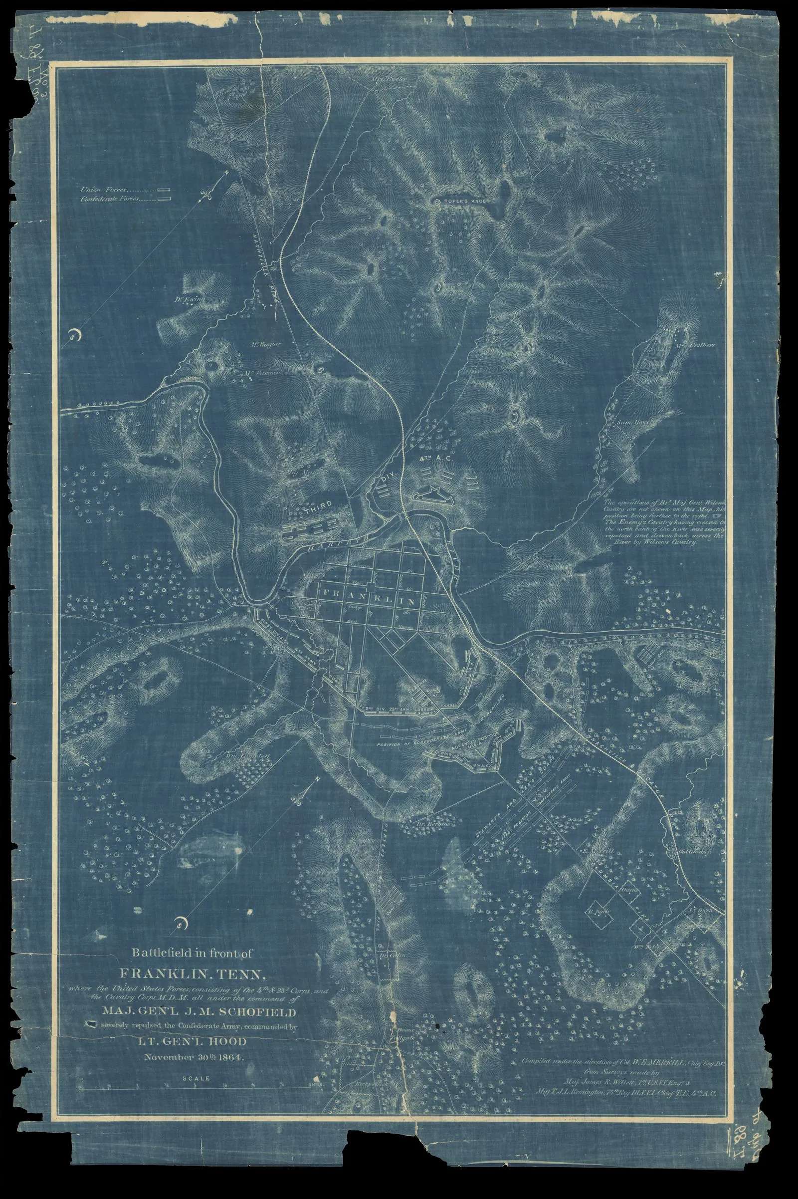
Battlefield in front of Franklin, Tenn.. Merrill, W. E. (William Emery), 1837-1891; Willett, James R. (James Rowland), 1831-1907; Remington, T. J. L. · Tennessee State Library and Archives, Map Collection (TeVA) · 1874 · No copyright - United States (rightsstatements.org NoC-US, as assigned by TSLA)
When Tennessee left the Union in 1861, Columbia was the second-largest town in Middle Tennessee and sat on the one railroad running south from Nashville. That made it a prize. Union troops marched in in March 1862, after the fall of Nashville. Confederates took the town back about six months later, and the Union returned in 1863. Before they left the first time, Union soldiers burned Jackson College.
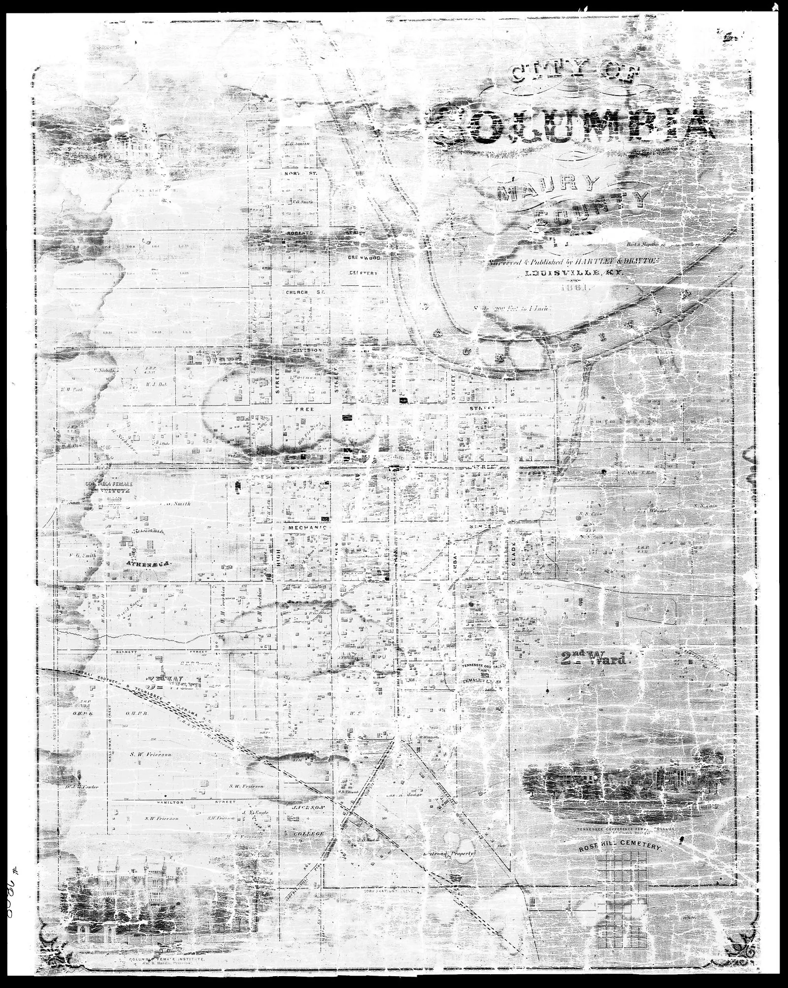
For most of the war, then, Columbia was an occupied town. Federal garrisons guarded the Nashville and Decatur Railroad and its bridges over the Duck River. Farms in the county, including the ones along Knob Creek, lived with foraging parties, requisitions and patrols. For enslaved people the arrival of the Union army was something else: a chance. Some walked to the Union lines. Four men held at Rippavilla escaped and enlisted in the U.S. Colored Troops.
Hood's last gamble
In the fall of 1864, after Atlanta fell, Confederate General John Bell Hood turned his Army of Tennessee north. His plan was to retake Nashville. Between him and the city stood a Union army under John Schofield, falling back along the Columbia Pike, the old road that is now U.S. 31.
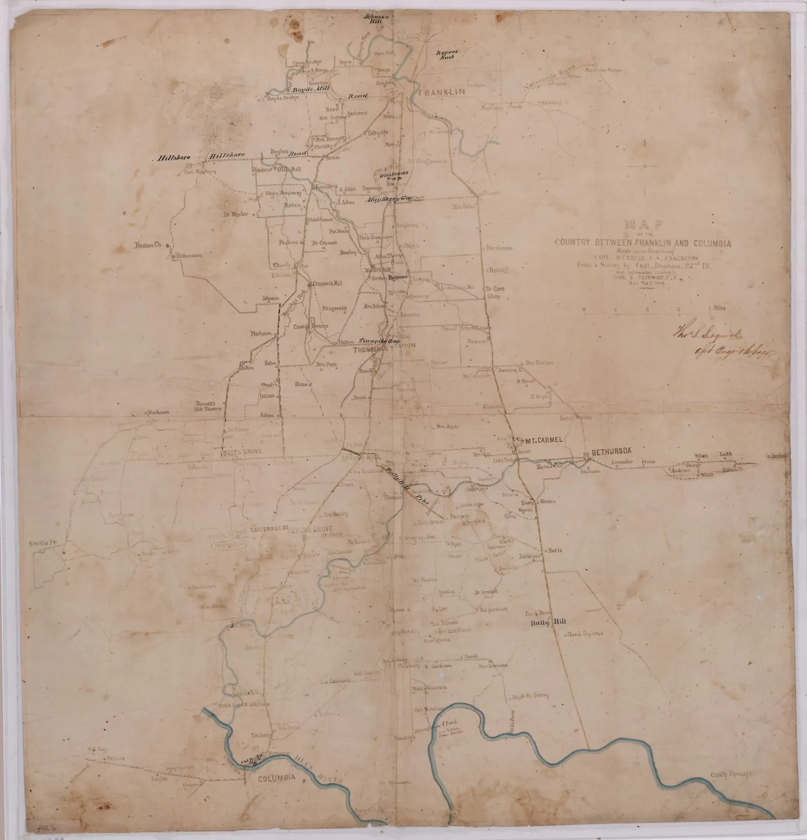
The armies met first at Columbia. From about November 24 to 29, Schofield held the north bank of the Duck River while Hood faced him from the town. Columbia saw its heaviest fighting of the war in those days. Then, on November 29, Hood left one corps to make noise in front of Columbia and took the rest of his army across the river upstream, aiming to get behind Schofield at Spring Hill.
Spring Hill
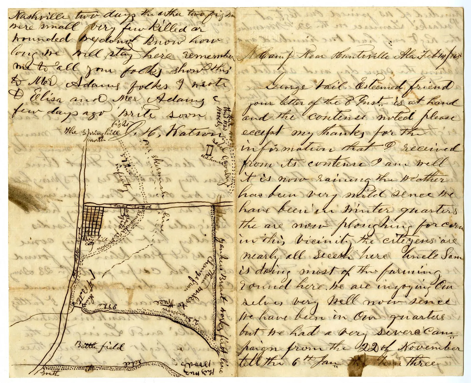
It nearly worked. By afternoon Confederate troops were within reach of the pike at Spring Hill, the Union army's only road north. Patrick Cleburne's division struck a Union brigade but never reached the road. As night fell, orders crossed and stalled. Through the dark, about 27,000 Union soldiers and their wagons marched up the pike past Confederate campfires, some only a couple of hundred yards away.
On the morning of November 30, Hood met with General Benjamin Cheatham at Rippavilla, the Cheairs house just south of Spring Hill. What they said is not recorded. Hood was furious that the Union army had escaped, and he ordered a pursuit.
Franklin
Schofield's men reached Franklin, about a dozen miles north, before dawn. They dug in on the south edge of town in a curving line that ran past the Carter family's brick farmhouse and its cotton gin. Union General Jacob Cox made the Carter parlor his headquarters.
At 4 p.m. Hood sent two corps across about two miles of open ground from Winstead Hill, straight at the Union works. It was one of the largest frontal assaults of the war. The fighting at the Union line, around the Carter House and the gin, went on into the dark, hand to hand. During the battle the Carter family, a neighbor family and several enslaved people sheltered in the basement. Tod Carter, a Confederate captain and a son of the house, was mortally wounded within sight of home. He died there two days later.
The cost was staggering. The American Battlefield Trust counts 6,252 Confederate casualties and 2,326 Union casualties in about five hours. Six Confederate generals were killed or mortally wounded, Cleburne among them, more than in any other battle of the war. That night Schofield's army pulled out for Nashville, where Hood's army was destroyed two weeks later.
Carnton
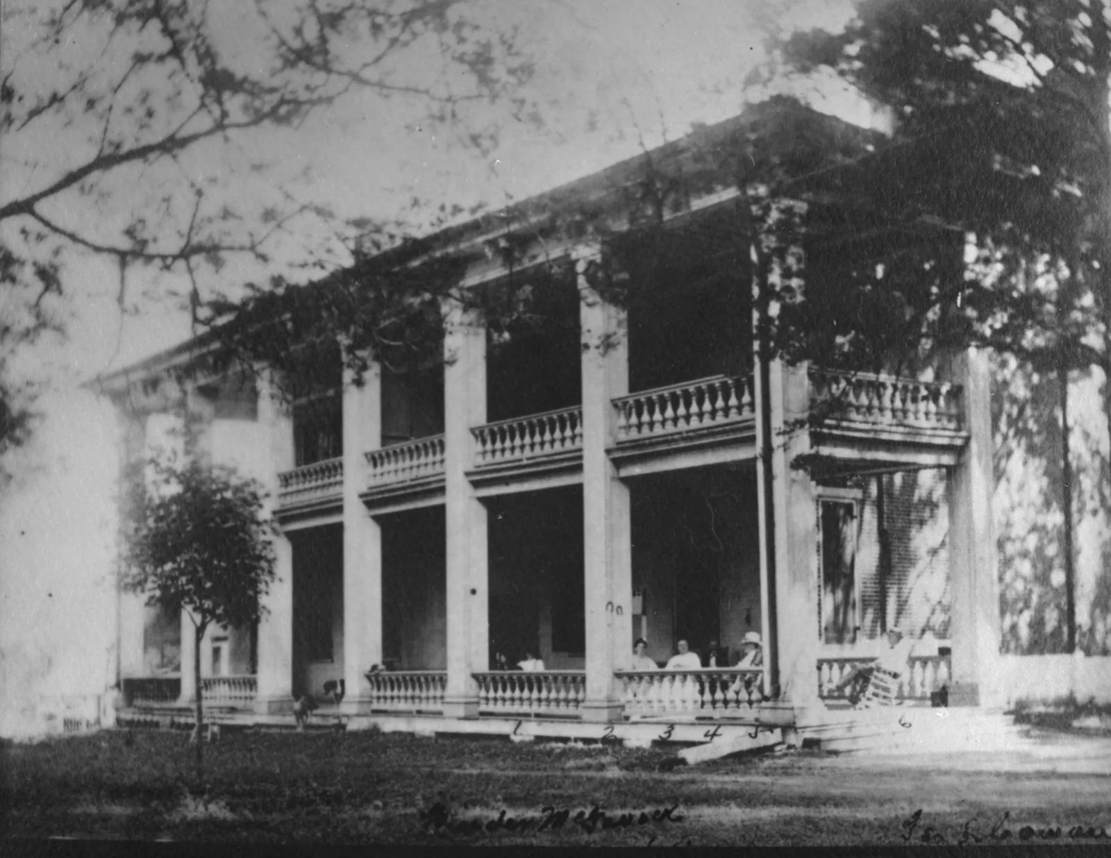
A mile east of the Carter House stood Carnton, the McGavock family home. It became the largest field hospital in the area. On the morning of December 1, the bodies of Generals Cleburne, Granbury, Adams and Strahl lay on its back porch. In 1866 John and Carrie McGavock set aside two acres beside their family cemetery, and 1,481 Confederate soldiers were reburied there.
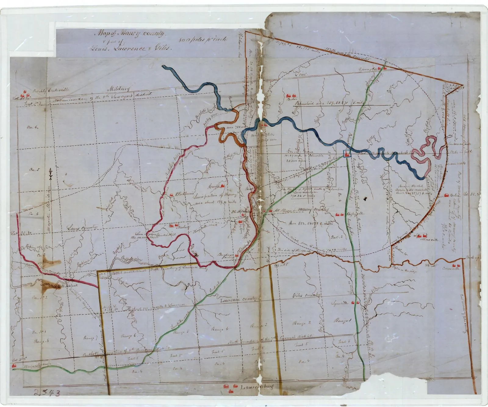
The farm on Knob Creek sits about 15 miles from the pike that carried both armies that week. Whether anyone on the hollow heard the guns at Columbia is not recorded. But every family in the county lived with what came after.
- Mar 1862Union troops occupy Columbia. Confederates retake it about six months later.
- 1863Union forces return to Columbia and hold it for most of the rest of the war.
- Nov 24, 1864Hood's army reaches the Duck River at Columbia. Schofield's Union army digs in north of the river.
- Nov 29, 1864Hood crosses the river upstream and marches on Spring Hill. The Union army slips past in the night.
- Nov 30, 1864The Battle of Franklin begins at 4 p.m. In about five hours more than 8,000 men are killed, wounded or captured.
- Dec 1, 1864The bodies of four Confederate generals lie on the back porch at Carnton.
- 1866The McGavocks set aside two acres for the Confederate dead. 1,481 are reburied there.